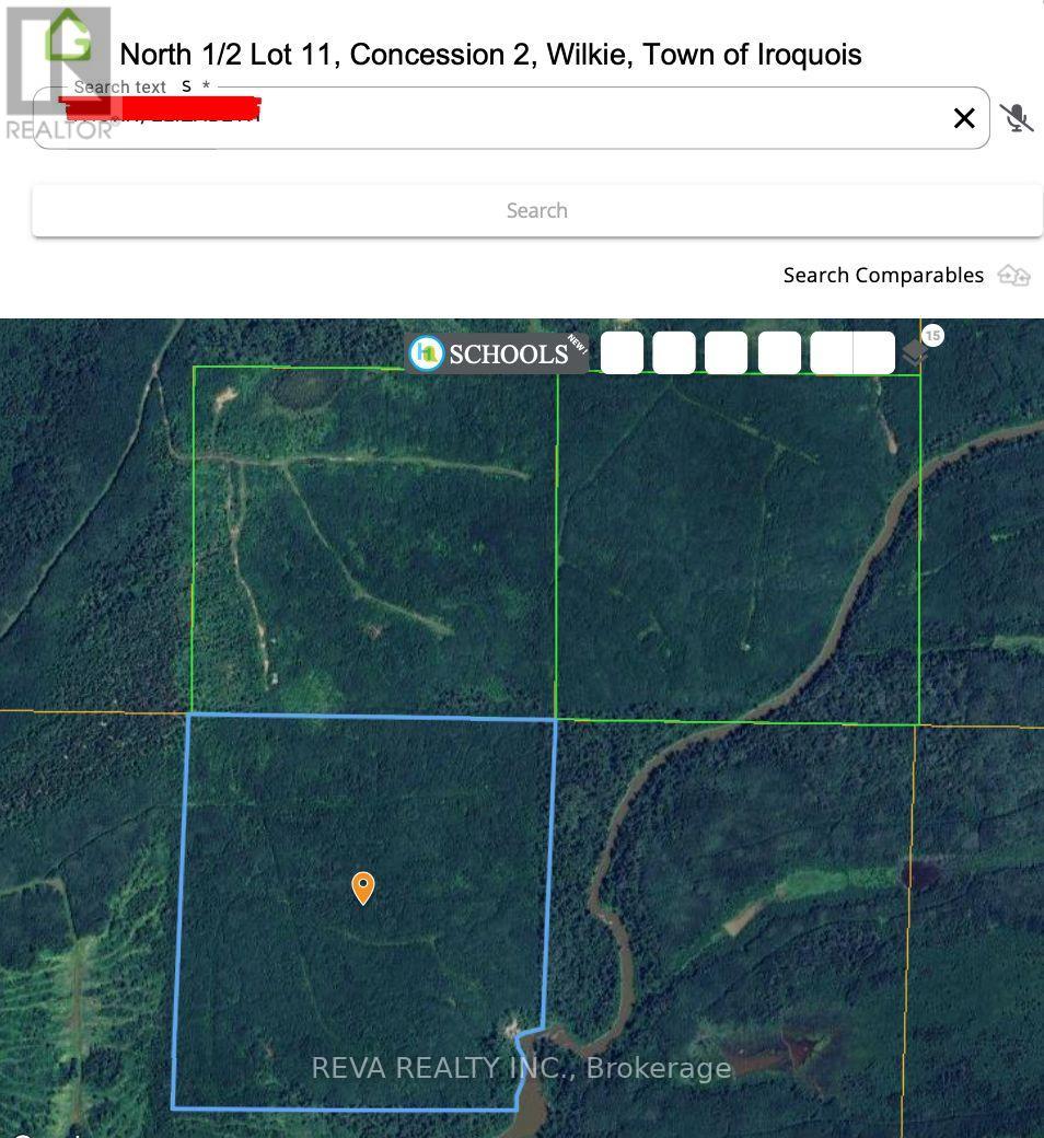
N1/2 Lot 11 Con 2 Wilkie Iroquois Falls, Ontario P0K 1G0
$319,000
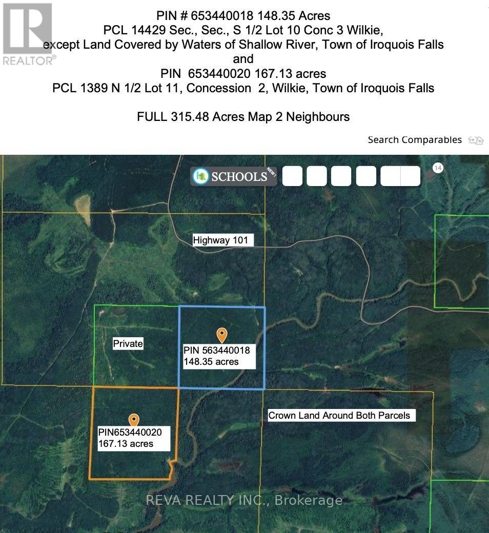
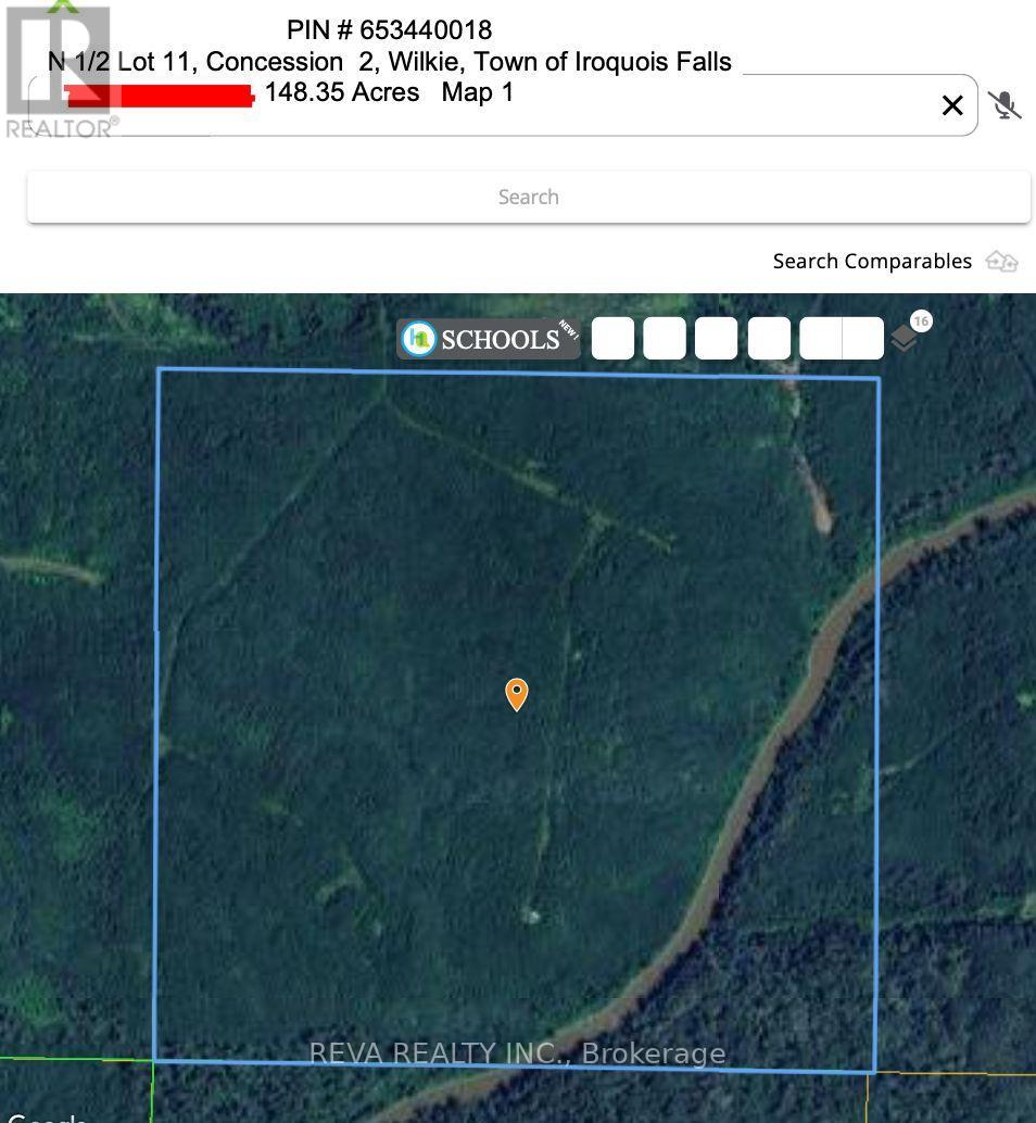
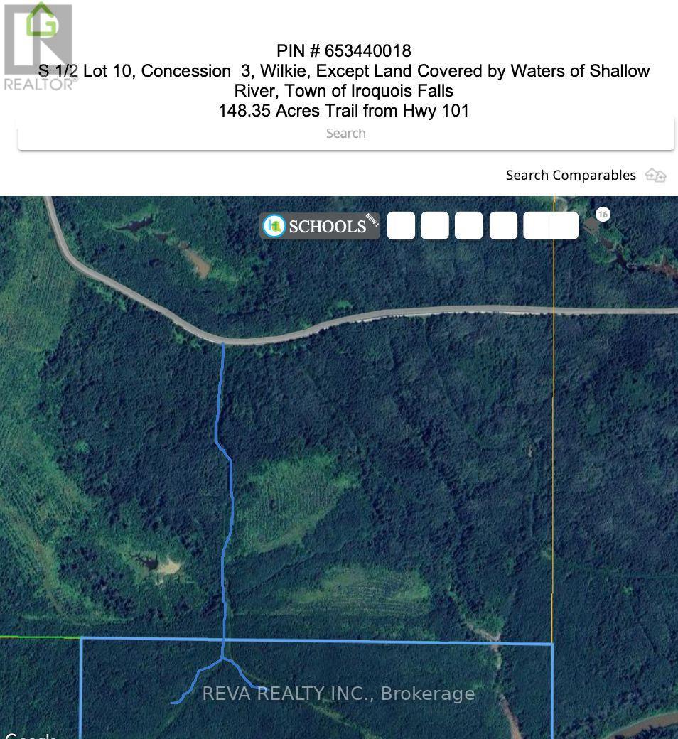
Near Mathesson, Ontario, lies 315 acres of forested Canadian Shield land with access off Highway 101 and/or across Crown Land logging roads. The 167.13 acre and 148.35 acre parcels are surrounded mostly by Crown Land. Great for hunting land, recreational land or investment. Off Grid, no hydro, well, septic, or direct access from a municipal road. The 148 acre parcel is closest to Highway 101, please review the maps carefully. Recently harvested neighbour's lands will have moose, deer, etc., feeding on new growth next door. The Shallow River borders these 2 parcels on the east the property's southeast corner, where rapids and canoeing exist. Showings with a Realtor, please, no trespassing. (id:60234)
Property Details
| MLS® Number | T10929490 |
| Property Type | Vacant Land |
| Community Name | Iroquois Falls |
| Easement | Environment Protected, Unknown |
| Features | Wooded Area, Irregular Lot Size, Rolling |
Building
Land
| Access Type | Highway Access |
| Acreage | Yes |
| Size Depth | 2822 Ft ,9 In |
| Size Frontage | 2622 Ft ,5 In |
| Size Irregular | 2622.42 X 2822.8 Ft ; 315.48 Acres In Total With 2 Pin's |
| Size Total Text | 2622.42 X 2822.8 Ft ; 315.48 Acres In Total With 2 Pin's|100+ Acres |
| Zoning Description | Ru, Ep |
Contact Us
Contact us for more information

The trademarks REALTOR®, REALTORS®, and the REALTOR® logo are controlled by The Canadian Real Estate Association (CREA) and identify real estate professionals who are members of CREA. The trademarks MLS®, Multiple Listing Service® and the associated logos are owned by The Canadian Real Estate Association (CREA) and identify the quality of services provided by real estate professionals who are members of CREA. The trademark DDF® is owned by The Canadian Real Estate Association (CREA) and identifies CREA's Data Distribution Facility (DDF®)
February 25 2026 01:10:42
Central Lakes Association of REALTORS®
Reva Realty Inc.